


GPS Waypoint Finder

Descrição do GPS Waypoint Finder
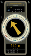
Uses the GPS sensor, Magnetic Field Sensor and Accelerometer to determine the distance and direction to a GPS waypoint. Does not need to be held level. Free & No Ads.
Normally a compass needs to be level to get the correct reading, but this app uses the accelerometer reading to convert the magnetic field reading back to the horizontal plane.
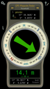
In addition to the direction and distance to the waypoint, a compass ring shows the current heading. North points to True North (i.e. The direction is corrected for the magnetic declination - the difference between magnetic north and true north).
The GPS reading and the time since that reading is shown at the bottom of the screen.
Use for geocaching, finding your car, hotel, or other locations.
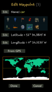
• Store up to 500 waypoints.
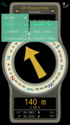
• Imperial or Metric units.
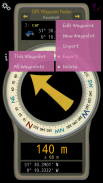
• Import and Export waypoints as GPX files.
Arrow colour changes to green at less than 30m and blue at less than 10m to make it easier for littler ones to identify that they've reached the waypoint.
Whilst walking, look where your going, not at the app or you might trip! The app tells you the direction of your destination, not how to get there.
Only as good as the sensors in your device. Use for Indication Only.
</div> <div jsname="WJz9Hc" style="display:none">Usa o sensor de GPS, sensor de campo magnético e acelerômetro para determinar a distância e direção para um waypoint GPS. Não precisa ser realizada nível. Anúncios Grátis & Nenhum.
Normalmente, uma bússola precisa ser para obter o nível de leitura correcto, mas esta aplicação usa a leitura acelerómetro para converter o campo magnético de leitura para trás em relação ao plano horizontal.
Além de a direção ea distância para o waypoint, um anel da bússola mostra a direção atual. Pontos Norte para Norte verdadeiro (ou seja, A direção é corrigido para a declinação magnética - a diferença entre o norte magnético eo norte verdadeiro).
A leitura de GPS e o tempo decorrido desde que a leitura é mostrado na parte inferior da tela.
Use para geocaching, encontrar o seu carro, hotel ou outros locais.
• armazenar até 500 waypoints.
• unidades imperiais ou métricas.
• Importação e Exportação waypoints como arquivos GPX.
Arrow cor muda para verde a menos de 30m e azul a menos de 10m para torná-lo mais fácil para os littler identificar que eles atingiram o ponto de passagem.
Enquanto uma caminhada, olha onde você está indo, e não no aplicativo ou você pode tropeçar! O aplicativo informa a direcção do seu destino, não como chegar lá.
Apenas tão bom quanto os sensores do dispositivo. Use para única indicação.</div> <div class="show-more-end">


